I’ve moved the domain for my “Overseas Cycling Travel Blog” https://joyscycle.com, which I maintained for three years, to https://bikeride.travel.blog.
This blog will primarily feature photos from my trip around Japan six years after returning home. I’ve posted a few photos from Hokkaido as a preview.
3年間続けた「海外自転車旅のブログ」https://joyscycle.com のドメインを https://bikeride.travel.blog に移動しました。
このブログでは、帰国から6年後に日本一周した時の写真を中心にアップしていくつもりです。今回その一部、北海道での写真をいくつか載せてみました。
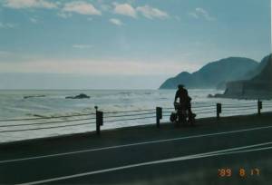
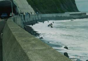
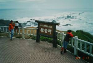
I’m riding along the Pacific Ocean-facing “National Route 336 (Golden Road)” from Cape Erimo to Hiroo Town. The “Golden Road” earned its name because the construction costs were enormous due to the road running along sheer cliffs. The center photo shows the harvesting of “Hidaka Kombu” seaweed.
「襟裳岬」から広尾町への太平洋に面した「国道336号線(黄金道路)」を走ります。「黄金道路」は、断崖絶壁を行く道路のため工事に莫大な費用がかかったことからその名がつきました。中央の写真は「日高昆布」採りのようすです。


This is National Route 336, where you cross the Tokachi River by boat because there’s no bridge. You pull yourself across to the other bank by hand using a rope. Naturally, cars have to take a detour. This national highway, connected by Japan’s last remaining ferry crossing, is also called the “Naumann Highway” because fossils of the Naumann elephant were excavated along the road past Hiroo Town.
The photo below shows the old man who’s been running this hand-operated ferry service for 23 years. He was excited to have me aboard, saying, “It’s been a while since I had a passenger.” He also mentioned, “I’ll retire in two years when a bridge is built downstream.” The ferry has a capacity of five people. Bicycles are OK, but motorcycles are not allowed.
橋がないため十勝川を船で渡る「国道336号線」です。手でロープを手繰りながら向こう岸へと渡ります。当然、車は迂回路を行くことになります。この日本で最後の渡船でつなぐ国道は、広尾町を過ぎた道沿いからナウマン象の化石が発掘されたことから「ナウマン国道」とも呼ばれています。
下の写真は手渡し業(?)23年のオジさんです。私を乗せて「久々の乗船客だ」と張り切っていました。「2年後に下流に橋が架かるので引退する」とも言っていました。渡船は定員5名、自転車は OK ですがバイクは NG でした。


The morning sun rising over the Shiretoko Peninsula as seen from the Abashiri side. The photo below shows the main entrance of Abashiri Prison, which opens every morning at 6:30 AM. The gate opened just 30 seconds after this photo was taken.
網走側から見た「知床半島」越しに昇る朝日です。下の写真は「網走刑務所」の正面入口、毎朝6時30分に開門します。この写真を撮った30秒後に門が開きました。
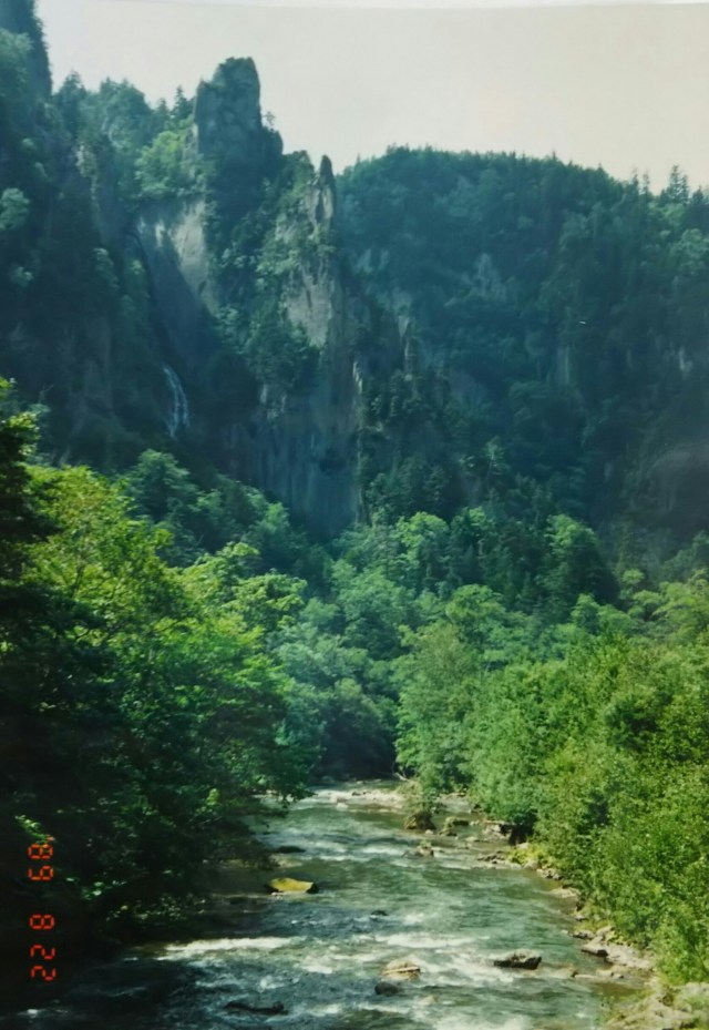
After crossing the Sekihoku Pass and passing Lake Taisetsu, you’ll arrive at Sounkyo, pictured here.
「石北峠」を越え「大雪湖」を過ぎると写真の「層雲峡」に出ます。


This is Cape Soya and Mount Rishiri-Fuji as seen from Rebun Island.
こちらは「宗谷岬」と礼文島から見た「利尻富士」です。


Finally, from top to bottom: the Sarobetsu Plains, the abandoned herring processing hut, and the red-brick (former) Hokkaido Government Office building constructed during the Meiji period(1868-1912).
I plan to post photos like this from time to time. I hope you’ll enjoy seeing what various parts of Japan looked like 30 years ago in 1989.
最後に、上から「サロベツ原野」、使われなくなった「ニシンの番屋」、そして明治期に建てられた赤レンガの「(旧)北海道庁舎」です。
不定期ですが、こんな感じで写真を載せていくつもりでいます。30年前の日本全国各地のようすをご覧いただければと思っています。
