Heading south from Wakkanai, I gaze at Rishiri Island and Rebun Island floating far offshore in the Sea of Japan as I drive about 40 kilometers across the barren Sarobetsu Plains. This area is designated as Rishiri-Rebun-Sarobetsu National Park.
稚内から日本海沖合い遠く浮かぶ利尻島と礼文島を眺めながら南下、40キロほど何もないサロベツ原野を走ります。このあたりは「利尻礼文サロベツ国立公園」に指定されています。
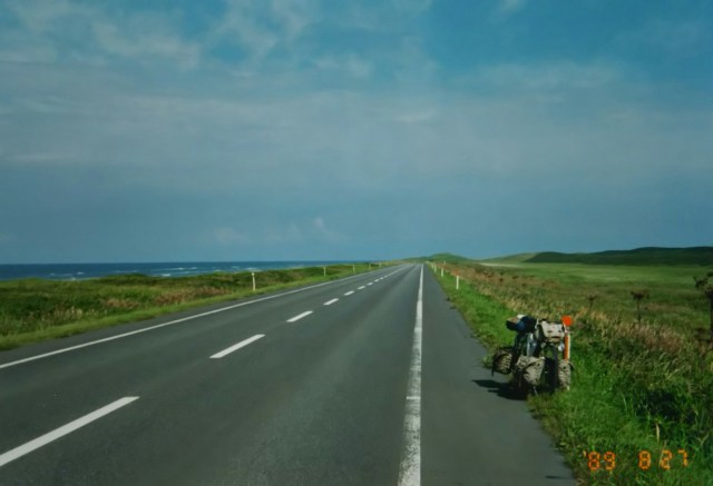
Upon reaching Teshio Town, it merges with National Route 232. This route is also called the Teuri National Highway, named after Teuri Island—one of two islands floating side by side off the coast of Haboro Town. Furthermore, the stretch from Ishikari to Teshio is also known as the Ororon Line, named after the Ororon bird, a seabird inhabiting Teuri Island.
天塩町までくると国道232号線に合流します。羽幌町の沖合いに二つ並んで浮かぶ島の一つ天売島(てうりとう)から232号線は天売国道とも呼ばれています。また、石狩から天塩までを天売島に棲息する海鳥、オロロン鳥にちなんで別名オロロンラインともいわれています。
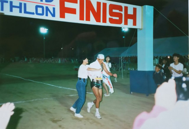

The Oloron Line between Haboro and Rumoi was hosting Japan’s longest triathlon, a 230-kilometer race completed in a single day. The competition lasted a full 15 hours. The photo shows the finish line in Haboro Town.
The next day, Typhoon No. 17 made landfall in Hakodate, trapping me in Haboro. I’d already been stuck once before in Hokkaido, when heavy rain and strong winds immobilized me near Asahikawa.
As the weather cleared, I set off again, passing through Rumoi and camping overnight at Tsurunuma in Urausu Town. The next day, I arrived in Sapporo.
ちょうど羽幌、留萌間のオロロンラインで日本で一番長い、1日で230キロを競うトライアスロンが開催されていました。その競技時間は15時間にも及びます。写真は羽幌町のゴールです。
翌日は函館に上陸した台風17号の影響で羽幌から動けませんでした。前にも旭川を過ぎたあたりで大雨と強風で身動きとれないことがあり、北海道で2度目の足止めです。
天気の回復とともに走り出し、留萌を経て浦臼町の鶴沼で野宿。その翌日、札幌に到着。
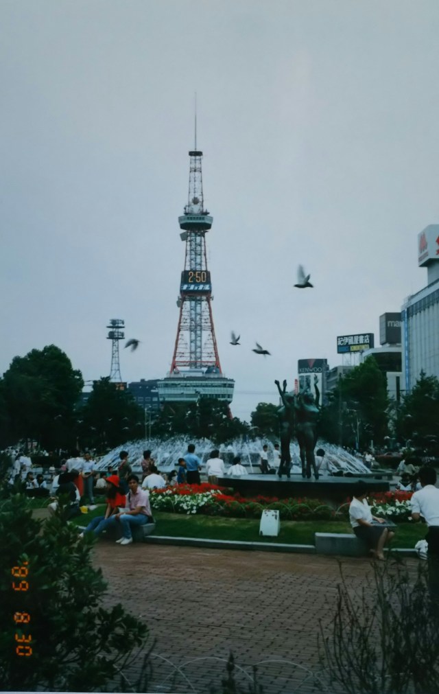
After touring the familiar TV Tower and Clock Tower, I headed to the Rider House in Makomanai, about 10 kilometers from the city center. One night costs ¥1,200, breakfast is ¥300, and dinner is ¥500. Showers are ¥200, laundry is ¥200. For the first time in Hokkaido, I slept under a roof. I stayed two nights among the bikers.
お馴染みのテレビ塔、時計台と回った後、街の中心から約10キロ真駒内のライダーハウスへ。1泊1,200円、朝食300円、夕食500円。シャワー200円、洗濯200円。北海道で初めて屋根の下で寝ます。バイクライダーに混じって2泊。
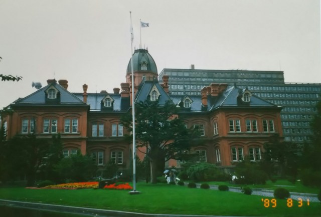
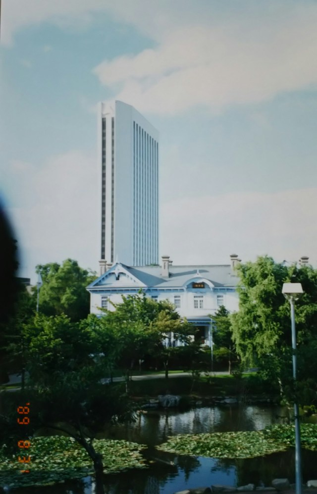
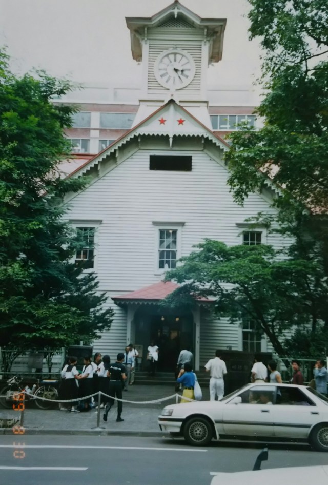
Sapporo’s population, which was 100,000 during the Meiji period(1868-1912), had already grown to 1.68 million by then, making it a major metropolis. The photo shows the old Hokkaido Government Office building, constructed during that Meiji period, with its distinctive red brick exterior. The next photo features the Hotel Arthur Sapporo, a high-rise building constructed in 1988. Standing 92 meters tall with one basement level and 25 above-ground floors, it was a particularly striking skyscraper at the time. It later changed its name to “Novotel Sapporo” and is now known as “Premier Hotel Nakanoshima Park Sapporo”.
After this, I visited “Sapporo Beer” and enjoyed the free drinks (complimentary drinks) after the factory tour. The snacks provided were more substantial than similar free drinks I’ve experienced overseas.
明治期に10万人だった札幌の人口も当時すでに168万人、大都会です。写真はその明治期に建てられた赤レンガの旧北海道庁舎です。次の写真は1988年に建設された地下1階、地上25階、高さ92m、当時ひときわ目立っていた高層ビル「ホテルアーサー札幌」です。その後「ノボテル札幌」に、そして現在は「プレミアホテル中之島公園 札幌」と名称を変えています。
この後「サッポロビール」を訪ねて工場見学後のフリードリンク(タダ酒)を味わいます。海外で経験したその種のフリードリンクよりツマミが充実していました。

From Sapporo to Hakodate via National Route 5, stopping at Otaru along the way. Otaru’s canal underwent various trials and tribulations during its development and renovation. Today, it shines as a tourist destination and a popular location for film and television shoots.
Next time, I’ll take the ferry back to Honshu from Hakodate.
札幌から国道5号線で函館へ、途中の小樽です。小樽の運河は色々とスッタモンダして整備、改修されました。それが今では観光地として、また映画やテレビのロケ地として脚光を浴びています。
次回、函館からフェリーで本州へ戻ります。
