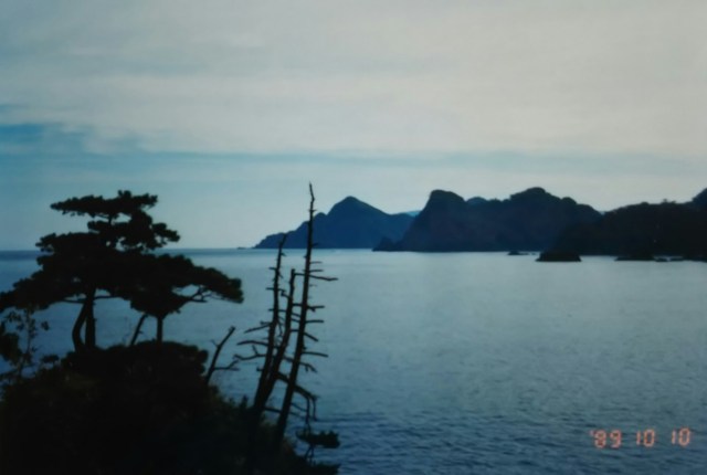
Driving through the fishing villages of Moroyose and Igumi from Hamasaka. Route 178 narrows slightly, but the beautiful coastline continues uninterrupted. After passing Igumi, Higashihama in Iwami Town, Tottori Prefecture, and the Tottori Sand Dunes are just over ten kilometers away.
浜坂から諸寄(もろよせ)、居組(いぐみ)と漁村を走り抜けていきます。178号線の道幅は少々狭くなりましたが、相変わらず美しい海岸線が続きます。居組を抜けると鳥取県岩美町の東浜、鳥取砂丘まであと10数キロです。
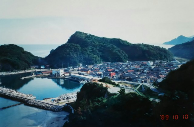
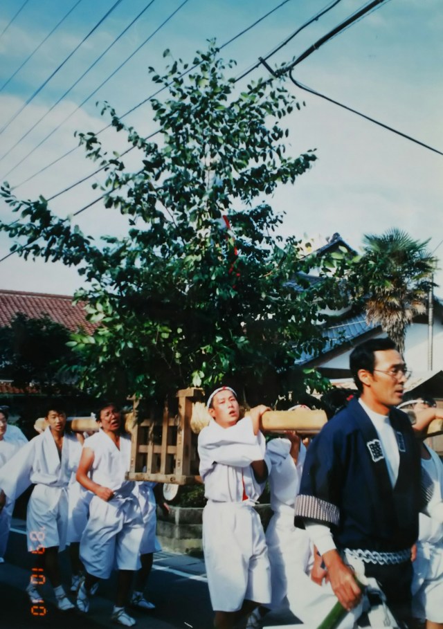
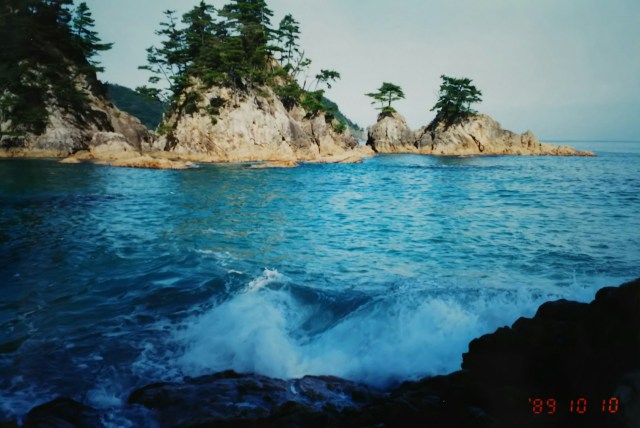
The second photo is of Igumi Fishing Port. Next is the autumn festival in the port town; what they’re carrying as a portable shrine is a large sacred branch (?). The last photo is of Nishiwaki Beach on Higashihama.
Further ahead, just before Tottori, it rejoins National Route 9.
2枚目の写真は居組漁港です。続いて港町の秋祭り、お神輿として担いでいるのは大きな玉串(?)でしょうか。最後は東浜の西脇海岸です。この先、鳥取の手前で国道9号線と再び合流します。
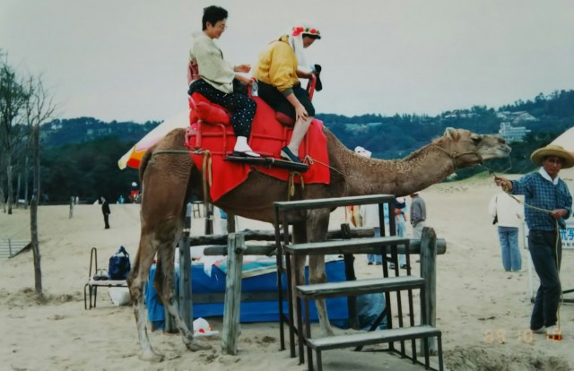
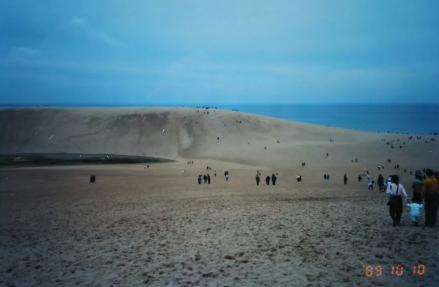
On the right side of Route 9, the Tottori Sand Dunes stretch out. On the left are rakkyo fields. At its widest point, the dunes extend nearly 2 kilometers to the coastline. A few camels, carrying tourists (¥2,000 per person), plod slowly along the area. I couldn’t help but laugh. Two people sit, one in front of the hump and one behind. They appear to be African single-humped camels.
During my overseas bicycle trip, I had seen camels grazing at the edge of the desert in Algeria, North Africa. I couldn’t confirm if they were for caravans or for meat, but seeing camels here suddenly brought back memories of that time. The camels at Tottori Sand Dunes are for tourism; you can imagine the inspiration came from the children’s song “Moonlit Desert.” It was October 10th, a national holiday (Health and Sports Day), so the place was bustling with tourists.
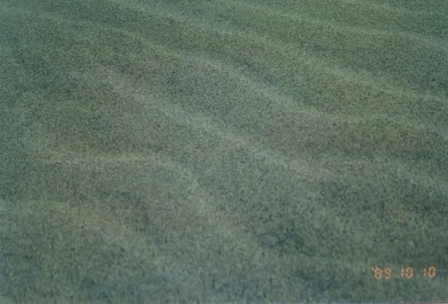
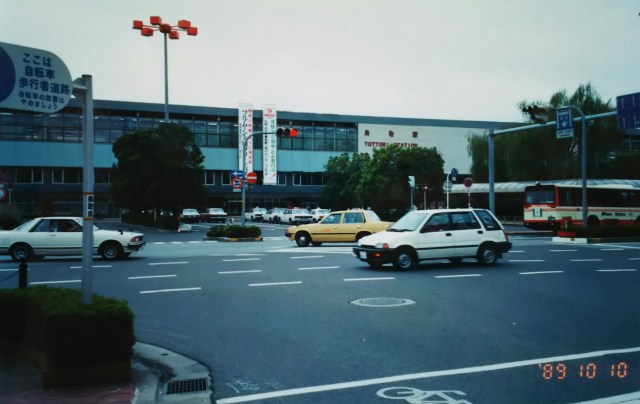
The third photo shows the wind patterns on the sand dunes. Apparently, if you go to the dunes early the morning after a windy day, before the tourists arrive, you can see clear wind patterns without any footprints. Finally, Tottori Station.
Stretching about 100 kilometers from Ayano Town at the western tip of the Tango Peninsula to the Tottori Sand Dunes, this area spans Kyoto, Hyogo, and Tottori Prefectures and is designated as the San’in Kaigan National Park. Following Japan’s application, UNESCO designated the San’in Kaigan National Park as a “Global Geopark” in 2010.
Heading from Tottori toward neighboring Shimane, I drove along the San’in Highway, National Route 9. This area has no other escape routes, making it extremely congested with cars. From Tomari Village to Hawaichō, I camped in a tent at a seaside park.
Next time, I head from Matsue to Izumo Taisha.
9号線の右手に鳥取砂丘が広がっています。左手はらっきょう畑です。砂丘は広い所で海岸線まで2キロ近くあります。観光客を乗せて(一人、2,000円)、数頭のラクダがその辺をのそりのそりと歩いています。思わず笑ってしまいました。コブの前後に二人座っています。アフリカ系のひとコブラクダのようです。
私は海外自転車旅の際、北アフリカのアルジェリアの砂漠の端っこで放牧中のラクダを目にしていました。キャラバン用か食肉用か確認はできませんでしたが、ラクダを見るのはそれ以来、ふと当時のことが思い出されました。鳥取砂丘のラクダは観光用、童謡「月の沙漠」にヒントを得たのが想像できます。この日は10月10日「体育の日」で祝日ということもあり、かなりの観光客で賑わっていました。
3枚目の写真は砂丘の風紋です。風の強い日の翌朝、観光客がやって来る前に砂丘へ行くと足跡のないハッキリした風紋を見ることができるそうです。最後は鳥取駅です。
丹後半島の西端、綾野町から鳥取砂丘まで約100キロほど、京都府・兵庫県・鳥取県にまたがり山陰海岸国立公園に指定されています。日本の申請を受け、2010年にユネスコは山陰海岸国立公園を「世界ジオパーク」に認定しています。
鳥取からお隣の島根を目指して山陰道、国道9号線を走ります。このあたりはほかに逃げ道がなく、車で大変混んでいます。泊村から羽合(はわい)町へ、海辺の公園でテント泊となりました。
次回、松江から出雲大社へ向かいます。
