South of Akiyoshidai, Japan’s largest karst plateau, lies Akiyoshi Cave. From here, I head north along the toll road “Akiyoshidai Road,” which runs through the center of Akiyoshidai, towards Hagi.
日本最大のカルスト台地、秋吉台の南に位置しているのが秋芳洞です。この先は秋吉台を縦貫する有料道路「秋吉台道路」を北へと走り抜け、萩へ向かいます。
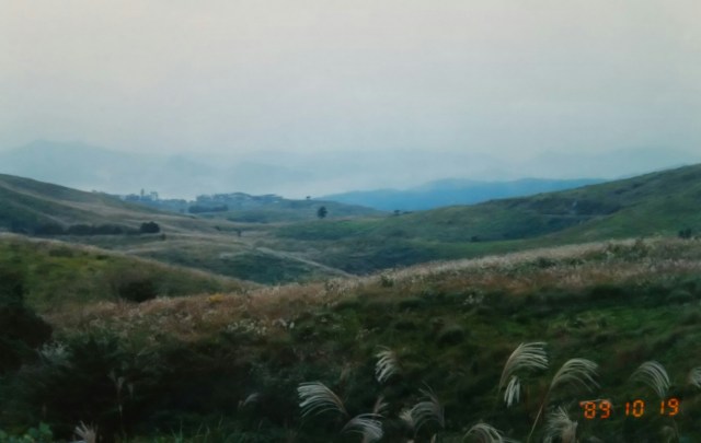
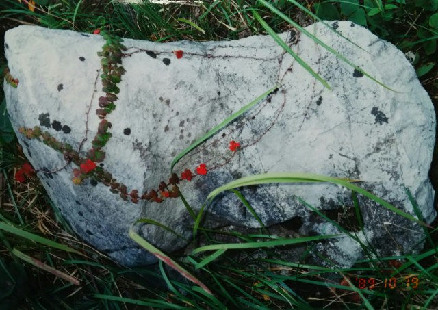
Akiyoshidai is a plateau formed from limestone layers uplifted from coral reefs 300 million years ago. Beneath the ground lie over 400 limestone caves, including Akiyoshi Cave. The toll road winds through rolling hills at elevations of 200 to 400 meters, with gentle curves and ups and downs. In places, limestone outcrops like the one in the photo are exposed.
Feeling the hint of autumn… But then, a light drizzle begins to fall, so I hurry on. The toll road became free the following year, 1990 (bicycles were always free), and is now called the “Karst Road.”
By the way, it’s a bit confusing that it’s called Akiyoshi Cave when it’s located in Akiyoshi. Originally, locals referred to limestone caves as “waterfall caves.” In 1926, the Crown Prince (later Emperor Showa) visited this area. Taking this opportunity, the prefectural governor at the time requested “some good name.” In response, the Chief Chamberlain of the Crown Prince named it Shuho Cave. Perhaps they considered the difference in nuance between the characters, even though both contain “Yoshi.”
In 1955, four villages surrounding Akiyoshi Village merged to form Shuhō Town (pronounced “Shūhō-chō”). At the same time, Akiyoshi remained as a district name. Locally, Shuhō Cave is sometimes called “Shūhōdō,” which is also confusing.
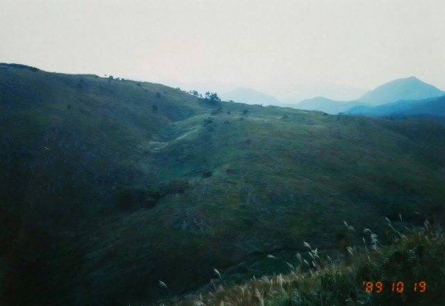
After crossing Hibari Pass from the toll road onto the prefectural road, a gentle descent continues all the way to Hagi.
Hagi is a castle town built on the alluvial fan of the Abugawa River. For better or worse, it’s compact and well-organized.
Mōri Terumoto moved from Hiroshima to Hagi and built Hagi Castle. For a long time, until it was moved to Yamaguchi in the late Edo period, Hagi served as the administrative center of the Chōshū Domain (Hagi Domain).
秋吉台は3億年前の珊瑚礁が隆起した石灰岩層の台地です。地下には400もの鍾乳洞があり、秋芳洞もその一つです。有料道路は緩やかなカーブとアップダウンを繰り返しながら標高200~400mの丘陵地帯を進んでいきます。所々、写真のような石灰岩が露出しています。
秋の気配を感じて…… ところがポツリ、ポツリと小雨が、先を急ぎます。有料道路は翌1990年に無料化され(もともと自転車は無料)、今は「カルストロード」と呼ばれています。
ところで秋吉にあるのに秋芳洞、何だかまぎらわしいです。もともと地元では鍾乳洞を「滝穴」と呼んでいました。1926年、この地に東宮(皇太子、後の昭和天皇)行幸があります。それを機に当時の県知事が「何かよい名を」と願い出ます。それに応えて東宮侍従長が秋芳洞と名付けたそうです。同じ「よし」でも文字のニュアンスの違いを考えたということでしょうか。
1955年に秋吉村の周辺の四つの村が合併し、秋芳町(こちらの呼び名はしゅうほうちょう)となります。と同時に秋吉も地区名として残ります。地元では秋芳洞を「しゅうほうどう」と呼ぶこともあるようで、これまたまぎらわしいです。
有料道路から県道へ、雲雀(ひばり)峠を越えると萩まで緩やかな下りが続きます。
萩は阿武川(あぶがわ)の扇状地に開けた城下町です。良くも悪くもこじんまりとまとまっています。
毛利輝元が広島から萩に移り、萩城を築きます。幕末に山口に移されるまでの長きにわたり萩は長州藩(萩藩)の藩庁でした。

This photo shows the ruins of Hagi Castle. It’s located in the northwest part of town, near the sea. Hagi Castle was also known as Shizuki Castle, and the mountain behind it is Shizuki Mountain.
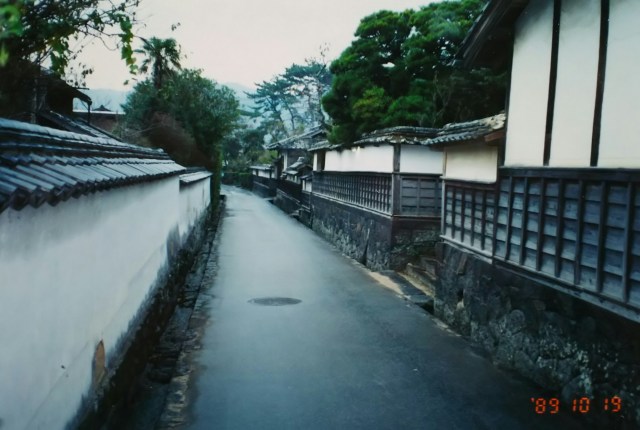
Next is the castle town, a street lined with samurai residences. The uniform white earthen walls are striking. There are guide signs for places like the former residence of Kido Takayoshi and the birthplace of Takasugi Shinsaku, though some sites only have the walls remaining, with no houses inside.
It is said that Hagi’s streetscape has remained almost unchanged since the Edo period. The reasons given are that the streets are too narrow to alter and that the layout was already perfected. The Choshu Domain championed the Sonno Joi (Revere the Emperor, Expel the Barbarians) movement and pushed for the overthrow of the shogunate. Hagi is considered the birthplace of the Meiji Restoration.
Around this time, the rain began to pour heavily, so I gave up on visiting Yoshida Shoin’s private school, the Shōka-sonjuku, and the former residence of Ito Hirobumi, both located in the eastern part of town.
In 2015, 23 sites nationwide were registered as the World Heritage site “Industrial Revolution of Meiji Japan.” Five of these are located in Hagi: the castle town, the Shōka-sonjuku private school, and the site of an Edo-period shipyard.
The next day, the rain cleared, and I headed to Shimonoseki via National Route 191. After passing Nagato, the road runs along the Sea of Japan.
写真は萩城跡です。街の北西、海の近くにあります。萩城は別名を指月城、後ろの山がその指月山です。続いて城下町、武家屋敷が並ぶ通りです。白い土塀に統一されているのが印象的です。木戸孝允の旧宅、高杉晋作の生誕の地など案内標識がありますが、内に家屋がなく塀だけという所もあります。
萩の街並みは江戸時代とほとんど変わっていないそうです。理由は狭くて変えようがないのと、すでに街並みが完成されているからだということです。長州藩は尊皇攘夷を掲げ、討幕を推し進めます。萩は明治維新の発祥の地といわれています。
この頃から雨が本降りになり、街の東にある吉田松陰の私塾、松下村塾と伊藤博文の旧宅へ行くのを諦めました。
2015年、世界遺産「明治日本の産業革命遺産」として全国の23ヶ所が登録されました。城下町、松下村塾、江戸時代の造船所跡などその内の5つが萩にあります。
翌日は雨も上がり、国道191号線で下関へ。長門を過ぎると日本海に沿って走るようになります。
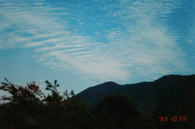


Cirrus clouds tell me, “It’s fully autumn now.” With just under 30 kilometers left to Shimonoseki, I camped at the Kokuseizan Observatory in Toyoura Town facing the Hibiki Strait that day. These are the sunset clouds over the Hibiki Strait I saw on the way to that observatory.
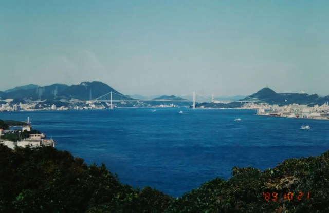
I arrived in Shimonoseki early, but I wasn’t crossing to Kyushu yet. Facing Kyushu, I wanted to see the night view of the Kanmon Straits. The spot I chose was Hiko Island, at the southern tip of Shimonoseki. Though called an island, three bridges connect it, making it feel almost like part of the mainland.
Haedomari Market, located at the western tip of Hiko Island, is known as Japan’s only market specializing in fugu (pufferfish).
うろこ雲が「すっかり秋だよ」と教えてくれています。下関まで30キロ弱、この日は響灘に面した豊浦町の国清山展望台でテント泊。その展望台へ向かう途中で見た響灘の夕焼け雲です。
下関に早々に到着しましたが、まだ九州へ渡りません。九州を前にして関門海峡の夜景が見たかったのです。選んだ場所は下関の南端、彦島です。島といっても3本もの橋がかかっており、陸続きの感じです。
彦島の西端にある南風泊(はえどまり)市場は日本で唯一のふぐの専門市場として知られています。
I pitched my tent on a small hill on Hiko Island, directly beside the Kanmon Bridge, waiting for nightfall. The Kanmon Bridge is a 1,068-meter-long expressway bridge spanning the narrowest point between Honshu and Kyushu. Its deck is 61 meters above sea level, designed to accommodate large ships. To the right of this photo location, across the strait, lies Moji in Kyushu, about 1 kilometer away—the second-shortest distance after the Kanmon Bridge itself.
The left side of the bridge leads to Dan-no-ura, famous for the Genpei War. At Dan-no-ura is the entrance to the two-tiered Kanmon Tunnel’s “Pedestrian Tunnel,” dedicated exclusively for people and light vehicles (bicycles, mopeds, etc.). While the upper-level tunnel is for cars only, the entrances are separate.
Parallel to the Kanmon Tunnel lies the Shinkansen tunnel, and just below where this photo was taken, the JR Sanyo Main Line tunnel. Three tunnels in total cross the Kanmon Strait. Though not visible here, the small island of Ganryu-jima, where Musashi and Kojiro fought, lies just ahead.
At 7 PM, I crawled out of my tent after finishing dinner. The surroundings had grown quite dark, and the headlights of cars crossing to and from Moji on the opposite shore seemed bright. Ships of all sizes crisscrossed the strait. Even after 8 PM, the number of vessels showed no sign of decreasing. Amidst them, small fishing boats continued their work, their lights flashing. The Kanmon Strait is a bustling thoroughfare for ships.
Next time, I’ll cross to Kyushu via the Kanmon Tunnel.
関門橋を真横に、彦島の小高い丘にテントを張って夜を待ちます。関門橋は本州と九州の最短部にかかる総長1,068mの高速道路橋です。大型船の航行を見越して海面までの桁下が61mあります。写真を撮ったこの地の右手は海峡をはさんで九州の門司、その距離約1キロ、関門橋の場所に次ぐ短さです。
橋の左側のたもとが源平合戦で有名な壇之浦です。その壇之浦には二層構造の関門トンネルの人間と軽車両(自転車、原付バイクなど)専用の「人道トンネル」の入り口があります。上層のトンネルが車専用ですが、入り口は別々になっています。
関門トンネルの先に並列するように新幹線のトンネル、そしてもう一つ、この写真を撮った足下に JR 山陽本線のトンネル、関門海峡には計3本のトンネルがあります。写っていませんが手前に武蔵と小次郎が闘った小さな巌流島があります。
夜7時、夕食を終えてテントから這い出しました。あたりはだいぶ暗くなり、対岸の門司を往き来する車のライトも明るく感じます。海峡内を大小様々な船が往来しています。夜8時を過ぎても航行する船はいっこうに減りません。そんな中、小型漁船が灯りを点滅しながら漁を続けていました。関門海峡は船の銀座通りです。
次回、関門トンネルで九州へと渡ります。
