After spending three days at my Tokyo home handling “driver’s license renewal, bike greasing, and an early visit to the graves,” I set off westward again on National Route 20 on Sunday, September 17th. I’ll be riding through Yamanashi and Nagano Prefectures toward the Sea of Japan coast in Niigata Prefecture.
For me, born in Tokyo, Route 20 is more like the Koshu Kaido. Along with the Ome Kaido, it’s a familiar main road I often cycled on since junior high, heading to lakes like Sagami and Okutama.
After passing the Ootarumi Pass on the Kanagawa border and enduring car exhaust fumes through the 3-kilometer-long Sasago Tunnel into Yamanashi, I descended rapidly into the Kofu Basin. I camped by the riverbank near Katsunuma.
Route 20 runs parallel to the Chuo Main Line. Stations like Ryuo, Nirasaki, Kobuchizawa, Fujimi, and Chino were frequently used for bike transport even after becoming a working adult, heading to destinations like the Minami-Alps Super Forest Road, Yatsugatake Highlands, and Takato. Unfortunately, riding in light rain meant I couldn’t see Mount Komagatake or the Yatsugatake range.
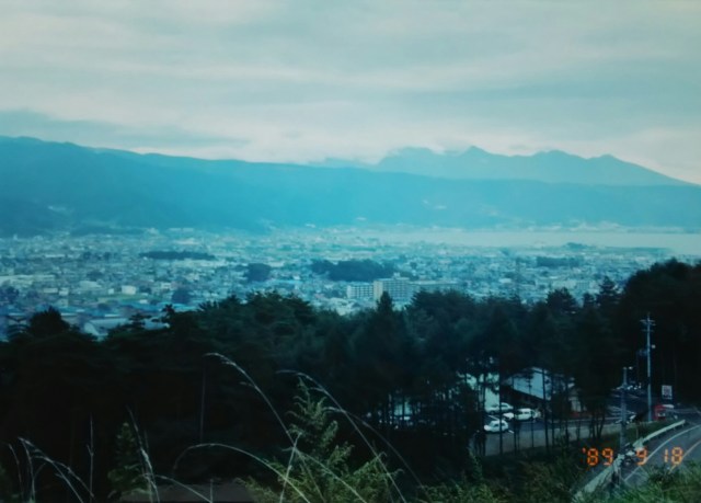
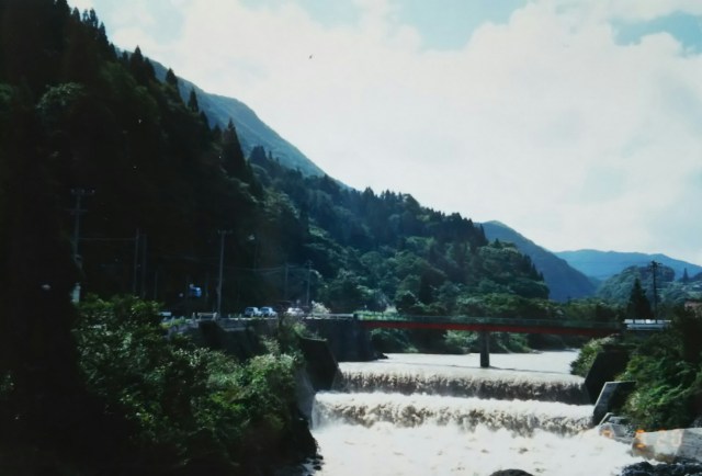
After freshening up at a public bath in Kami-Suwa, the relief was short-lived. By the time I approached Shiojiri Pass from Lake Suwa, heavy rain set in. I had no choice but to spend the night in the Shiojiri station building. The station announcement, “The Chuo West Line is delayed by about an hour and a half due to lightning strikes,” was met with a resigned “Well, that makes sense.” The photo is of Shimosuwa City. Heavy rain followed shortly after.
「運転免許の更新、自転車のグリスアップ、ちょっと早めの墓参り」と東京の自宅で3日間過ごし、9月17日(日)国道20号線を西へと再び出発。山梨県と長野県を経由して新潟県の日本海側へ向けて走ります。
東京生まれの私にとって20号線というより甲州街道。青梅街道とともに相模湖や奥多摩湖へ中学生の頃からサイクリングでよく走っていたお馴染みの幹線道路です。
神奈川県境の大垂水峠、山梨県に入り長さ3キロの笹子トンネルを車の排気ガスを我慢しながら抜けると、一気に甲府盆地へと下ります。勝沼を過ぎたあたりの河原でテント泊となりました。
20号線は中央本線と並行する形で延びています。竜王、韮崎、小淵沢、富士見、茅野とこのあたりの駅は「南アルプススーバー林道、八ヶ岳高原、高遠」など社会人になっても輪行でよく利用していました。残念なことに小雨の中の走行で駒ヶ岳や八ヶ岳が拝めません。
上諏方で共同浴場に入りサッパリしたのもつかの間、諏訪湖から塩尻峠に差し掛かる頃には大雨に。やむなくこの日は塩尻の駅舎泊。構内アナウスンスの「中央西線は落雷のため一時間半ほど遅れが出ています」に「さもありなん」。写真は下諏訪市内。この後、大雨になります。
The next day, I passed through Matsumoto and headed to Shinano-Omachi via National Route 147, which runs parallel to the JR Oito Line. Due to the rain, I could only ride about 50 kilometers, so I stayed at the station building in Shinano-Omachi again that night. On this day, Typhoon No. 22, which had made landfall in southern Kyushu, was moving along the Pacific coastline of the archipelago. It made landfall again on the Izu Peninsula and the southern part of the Boso Peninsula, causing damage across various parts of the islands.
The year 1989, Heisei 1, was what was called a “typhoon-prone year.” A record-tying five typhoons made landfall, with four concentrated between late July and mid-September. Among them, Typhoon No. 13, which made landfall in Choshi, Chiba Prefecture on August 6, claimed over 30 lives, including both dead and missing.
Even before that, on August 1st, Typhoon No. 12 approached the archipelago, causing landslides in the Kanto region and rivers to overflow in Tokyo. At that time, I had pitched a tent beside a rice field in Katsuta City, Ibaraki Prefecture, and was unable to move even after dawn. Someone who came to check the rising water level of a nearby river took pity on me and offered to let me take shelter at their home.
Several typhoons like this occurred that summer and fall, approaching Japan without making landfall yet still causing significant impact, resulting in rough weather nearly every week.
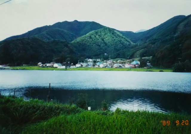
After passing Omachi, Route 147 becomes Route 148, continuing straight to Itoigawa on the Sea of Japan coast. Routes 147 and 148 together are called the Chikuni Kaido (Itoigawa Highway). Along the highway past Omachi, three lakes lie from south to north: Lake Kizaki, Lake Nakatsuna, and Lake Aoki. Collectively, they are known as the Nishina Three Lakes.
翌日は松本を経て JR大糸線に並行する国道147号線で信濃大町へ。雨のために走れたのは50キロほど、信濃大町で連日の駅舎泊。この日、九州南部に上陸した台風22号は太平洋岸を列島沿いに進み、伊豆半島と房総半島南部に再上陸、列島各地に被害をもたらしていました。
平成元年の1989年はいわゆる「台風の当たり年」でした。当時としては最多タイの5つの台風が上陸し、それも7月下旬から9月の半ば過ぎまで4つ集中していました。中でも8月6日千葉県銚子に上陸した台風13号は死者、不明者合わせて30名以上と多くの犠牲者を出しました。その前の8月1日にも列島に接近した台風12号の影響で関東地方では崖崩れ、東京でも河川が氾濫していました。この時、私は茨城県の勝田市内の田んぼの脇にテントを張っていたのですが、夜が明けても動けずにいました。近くの川の増水具合を見に来た人が見るに見かねて声をかけてくれ、その方のお宅に避難させてもらいました。このように上陸しないものの日本に接近して影響をもたらした台風も数個発生しており、この年の夏から秋にかけては毎週天候が荒れていたのです。
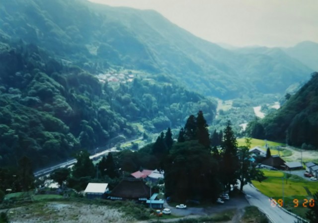
大町を過ぎると147号線は148号線となり、そのまま日本海に面した糸魚川へと繋がります。147号線、148号線合わせて千国街道(糸魚川街道)呼ばれています。大町を過ぎた街道沿いには南から木崎湖、中網湖、青木湖と三つの湖があり、合わせて仁科三湖と呼ばれています。
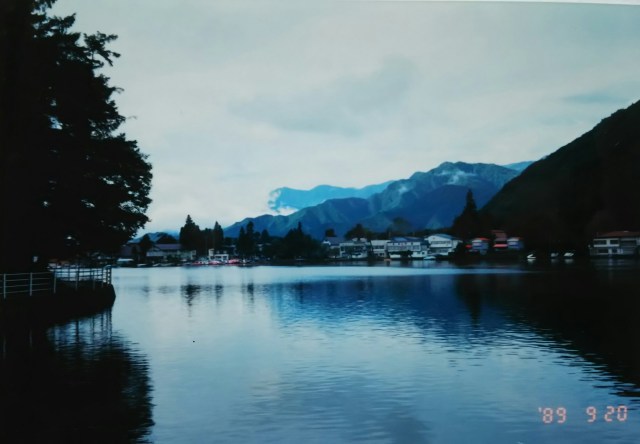
This photo shows Lake Aoki, the largest of the three lakes in the Nishina region. At an elevation of 832 meters and a depth of 62 meters, it is also the deepest. When you leave the main road and drive along the lakeshore, you can feel the tranquil atmosphere surrounding it.
写真は仁科三湖で一番大きな青木湖です。標高832m、水深62mも一番です。街道を外れ、湖畔を走ると周囲の落ち着いた雰囲気を感じます。
The river swelled due to the typhoon. I believe it’s a tributary of the Himekawa River, which originates in Hakuba Village and flows into the Sea of Japan. Next, a photo of the landslide. Can you see how the debris has advanced right up to the car in the lower left? At that time, helicopters were circling overhead, and the JR Oito Line was suspended.
台風の影響で増水した川。白馬村を水源地とし日本海へ注ぐ姫川の支流だと思います。続いて土砂崩れの写真。左下の車の手前まで土砂が迫っているのがわかりますか。この時、上空にはヘリコプターが旋回、JR大糸線は不通でした。
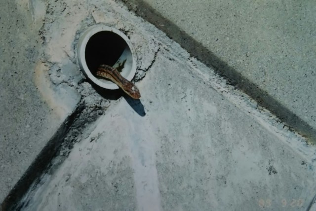
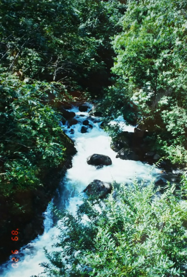
During a brief break in the clouds, even a snake(?!) peeked its head out. The babbling brook swelled and sparkled like a small river. Both are snapshots from Hakuba Village. Afterwards, I took a quick dip at Otari Village’s municipal hot spring (¥200 admission).
That night, I camped at Miyama Park, just before Itoigawa and close to the Himekawa River, our first tent stay in three days. Miyama Park is on high ground, so you should be able to see the Sea of Japan and the Northern Alps… but unfortunately, the weather was no good.
つかの間の晴れ間に蛇(?!)も顔を覗かせました。せせらぎも増水して小川のように輝いています。どちらも白馬村でのスナップです。その後、小谷(おたり)村の村営の温泉(入浴料200円)でひとっ風呂。
この日は糸魚川の手前、姫川に程近い美山公園で3日ぶりのテント泊。美山公園は高台ということで日本海と北アルプスが見渡せるはずなんですが… あいにくの天気でダメでした。
