From my friend’s place, it’s just a short ride to the Yodo River. I took the riverside bike path toward Kyoto. Like Nara, I’ve been to Kyoto twice on school trips, so I passed right through here and continued along National Route 9 (San’in Highway), which connects Kyoto and Shimonoseki. At Ayabe, I briefly left Route 9 for Maizuru on Wakasa Bay, then headed to Amanohashidate in Miyazu.
友人宅から淀川まではすぐ、淀川沿いのサイクリングロードを京都へ。京都は奈良同様、修学旅行で二度来てますし、ここは素通りして京都と下関を結ぶ国道9号線(山陰道)を進みます。綾部で9号線を一旦外れて若狭湾の舞鶴、そして宮津の天橋立へ。

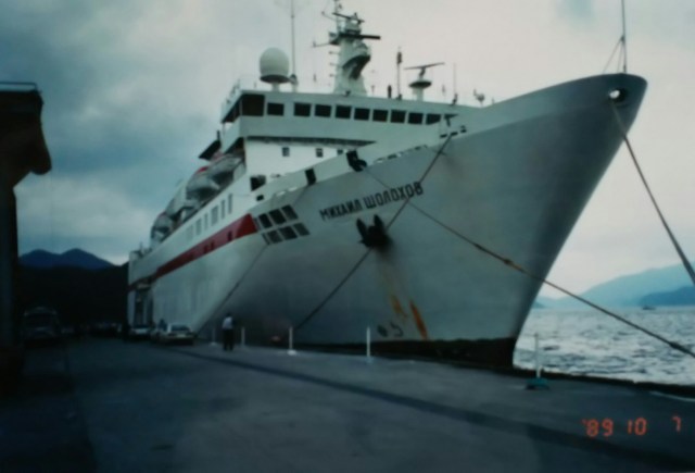

The photo shows Arashiyama, from where Route 9 begins. A Japan-Soviet friendship cruise ship docked at Maizuru Port, loaded with a large quantity of used cars. From Maizuru, I proceeded along National Route 178 to Amanohashidate in Miyazu Bay, featured in Japanese mythology.
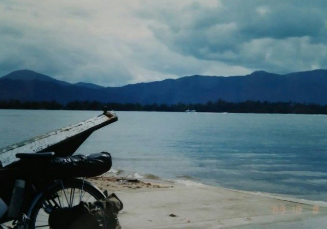
Amanohashidate is a sandbar formed where sand carried by coastal currents collides with rivers flowing into the bay. The sandbar, lined with pine forests, stretches about 3.5 kilometers. The space between it and the mountain range behind forms an inland sea. The sightseeing boat, or rather, the boat’s name is Space Shuttle 2 (?!).
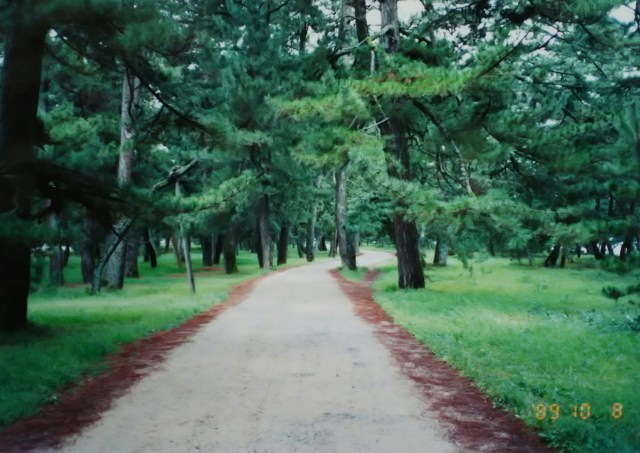
A walking path runs through the pine forest; after about 2.5 kilometers, you reach the opposite shore. After that, I drove straight through the base of the Tango Peninsula to Amino Town (now Kyotango City) facing the Sea of Japan. I took a bath at the Asamogawa hot spring—my first bath in three days since leaving Osaka.
写真は嵐山、ここから9号線へ。舞鶴港に接岸中の日ソ親善客船。大量の中古車を積み込んでいました。舞鶴から国道178号線を進み、神話にも登場する宮津湾の天橋立へ。
沿岸流で運ばれる砂が湾に流れ込む川とぶつかり合う形で堆積した砂州が天橋立です。松林が続く砂州の長さは3.5キロほど、後ろの山並みとの間は内海になっています。遊覧船というかボートの船名はスペースシャトル2(?!)。
松林の中は遊歩道、2キロ半ほど行くと対岸です。その後は丹後半島の付け根を突っ切って日本海に面した網野町(現京丹後市)へ。浅茂川の温泉風呂でひとっ風呂、大阪を発って以来三日ぶりの入浴です。
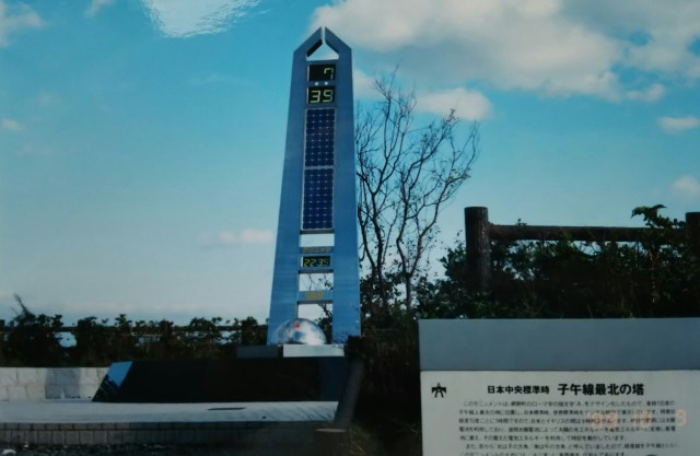
This photo shows the monument “Tower of the Northernmost Meridian” in Amino Town. It stands at 135 degrees east longitude, directly north of Akashi. The design features the initial “A” for Amino Town, with the time displayed as 7:39. The 22:39 below indicates Greenwich Mean Time. Beyond the monument lies the Sea of Japan.
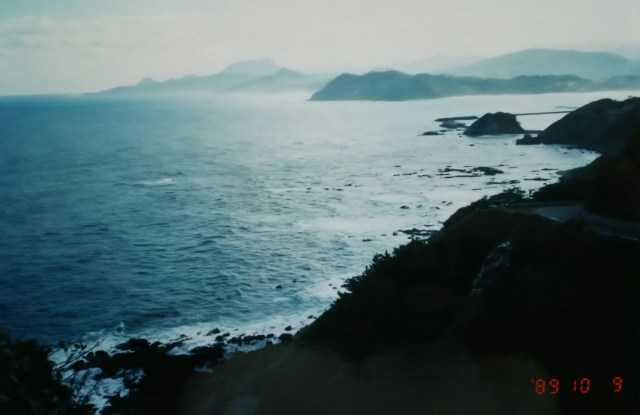
From Tango (Kyoto) to Tajima (Hyogo),this area is part of the San’in Kaigan National Park. Then on to the famous Amarube Bridge on the San’in Main Line.
写真は網野町にあるモニュメント「子午線最北の塔」です。東経135度、明石のま北に位置しています。網野町の頭文字Aのデザイン、時刻は7時39分、下の22:39はグリニッジの時刻。モニュメントの向こうは日本海です。
丹後(京都)から但馬(兵庫)へ、このあたりは山陰海岸国立公園。そして山陰本線の名物、余部(あまるべ)鉄橋へ。
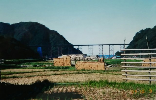
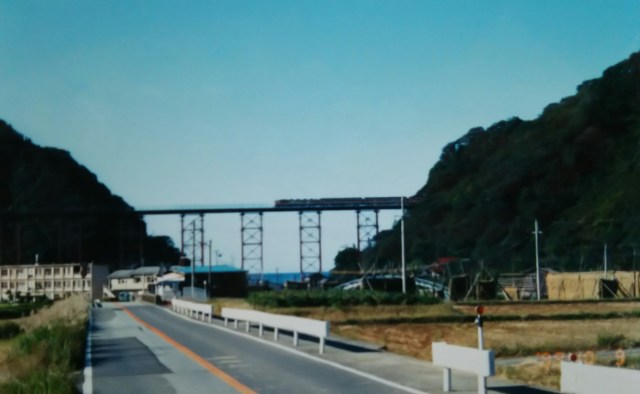
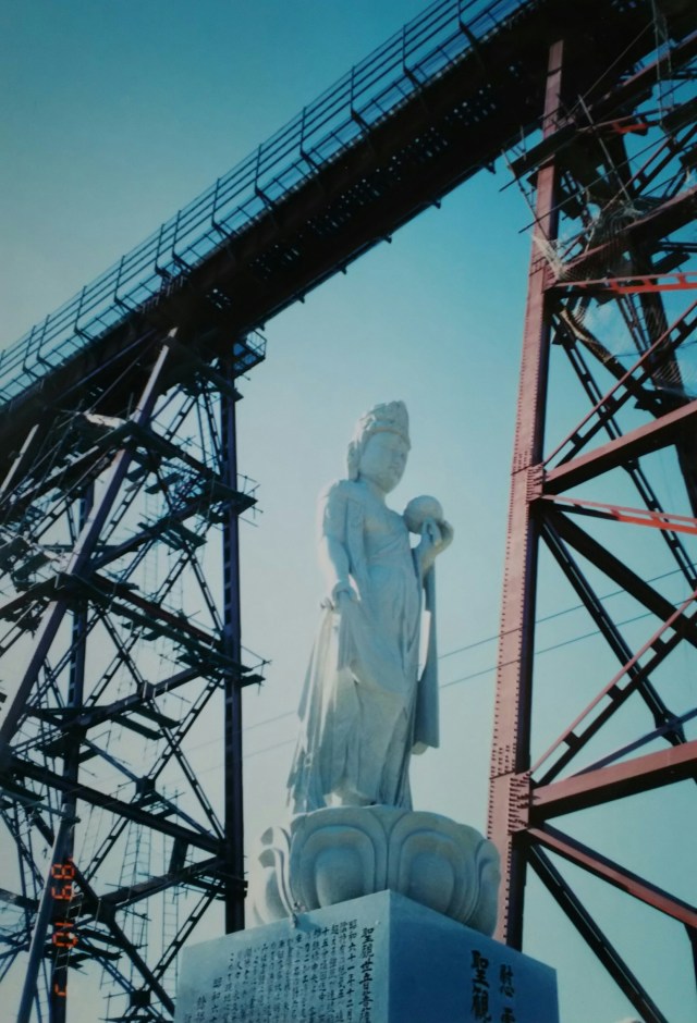
The Amarube Railway Bridge was completed and opened in 1912. Approximately 310 meters long and 40 meters high, this striking bright red bridge attracts many railway enthusiasts. However, a tragic accident occurred here at the Amarube Railway Bridge.
In December 1986, about three years before my visit, a shunting train was buffeted by strong winds, derailed, and fell. This resulted in the tragic loss of six lives: five housewives working at the canning factory directly below and the train conductor. Additionally, three factory employees and three onboard sales staff suffered serious injuries. The subsequent investigation revealed that one of the two anemometers used to determine train operation had malfunctioned, and the other was not functioning correctly.
Finally, there is a memorial monument and a statue of a bodhisattva beneath the bridge. In 2010, the Amarube Railway Bridge was replaced with a concrete bridge.
After passing through the tunnel from Amarube and traveling a short distance, you reach Hamasaka Town (now Shinonsen Town after merging with Onsen Town). On this day, I camped in a tent at Hamasaka Port.
Next time, I’ll head to the Tottori Sand Dunes.
余部鉄橋は明治45年に完成、開通した鉄橋です。長さ約310m、高さ約40m、印象的な真っ赤な橋梁、多くの鉄道ファンがいます。ただし、ここ余部鉄橋では残念な事故が起きています。私が訪れる三年ほど前の1986年12月、走行中の回送列車が強風にあおられ脱線、転落。真下の水産加工(製缶)工場で作業中の主婦5人と車掌の計6名の犠牲者が出てしまいました。ほかに工場の従業員3名、乗り合わせた車内販売員3名が重傷者となりました。事故後の調査で運行を判断する二つの風速計の一つが故障、もう一つが正しく作動していないことがわかりました。最後は鉄橋下の慰霊碑と菩薩像です。2010年、余部鉄橋鉄橋はコンクリート製の橋梁に変わっています。
余部からトンネルを抜け、しばらく走ると浜坂町(温泉町と合併後、現在の新温泉町)です。この日は浜坂の港でテント泊。
次回、鳥取砂丘へ向かいます。
