Route 9, the Hualien-Taitung Highway, becomes known as the Su-Hua Highway after passing through Hualien, continuing on to Suao.
From Hualien, via Xin Cheng, the Su-Hua Highway leads to the junction with Route 8, which serves as the entrance to Taroko Gorge. Route 8, known as the East-West Cross-Island Highway, winds through the 3,000-meter-high peaks of the Central Mountain Range and extends eastward to Taichung.
9号線、花東公路は花蓮を過ぎると蘇澳(スーアオ)まで蘇花公路と呼ばれるようになります。
花蓮から新城(シンチェン)を経て、蘇花公路は太魯閣峡谷への入口となる8号線との合流地点へ。8号線は東西横貫公路と呼ばれ中央山脈の3千m級の山の中を抜けて東側の台中(タイヂョン)まで通じています。
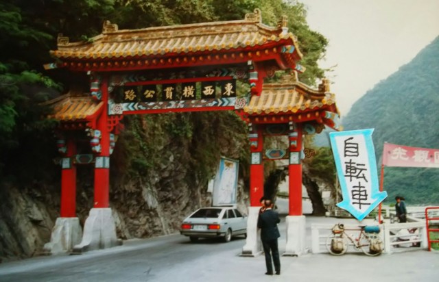
It’s a gate that looks very Chinese. To the right is Route 9, the Su-Hua Highway, which leads straight to Suao. Beyond the gate is a map of Taroko Gorge. It’s about 20 kilometers to Tianshang, the southernmost point of Taroko National Park, with an elevation gain of less than 500 meters—it doesn’t seem like a particularly steep climb.
Taroko (Tailuogao, commonly known as Taroko in Japan) is a curious name, but it apparently derives from the name of a tribe related to the Tayal, the indigenous people of this region.
いかにも中国っぽいゲートです。右はそのまま蘇澳へ続く9号線の蘇花公路です。ゲートの先に太魯閣峡谷の案内図があります。太魯閣国立公園の終点、天祥(ティエンシァン)まで約20キロ、標高差500m足らず、キツイ上りではないようです。
太魯閣(タイルーガォ、日本では一般的にタロコ)とは妙な名ですが、この地方の原住民タイヤル族の仲間の部族の名前に由来するそうです。
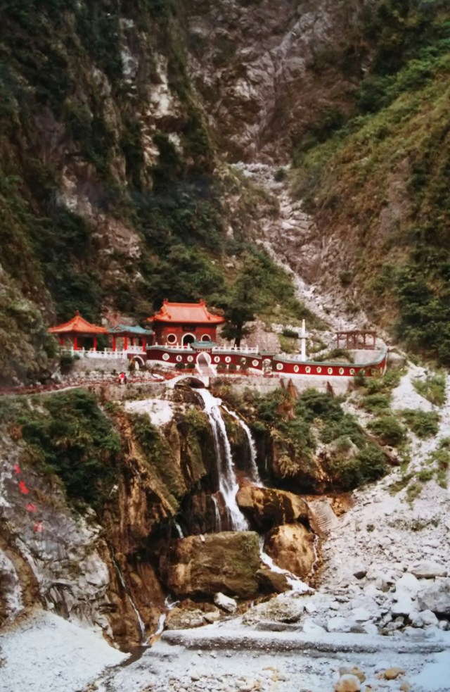
A little over two kilometers from the gate, just off the road on the left, you can see a palace-like building. This is the Changchun Shrine, dedicated to the spirits of those who lost their lives during the construction of the East-West Cross-Island Highway. This road was originally a path used by the Tayal people; during the Japanese colonial period, it was upgraded over a four-year period to serve as a transport route for materials needed to build a dam upstream.
After World War II, construction began to extend that road across the Central Mountain Range to the west. The soldiers mobilized for this project were brought from mainland China by the Kuomintang. It is said that this was part of Chiang Kai-shek’s unemployment relief program for soldiers. Due to the difficulty of the construction, many lives were lost.
ゲートから2キロちょっと、道路を外れた左手に何やら宮殿風の建物が見えます。東西横貫公路の工事中に殉職した人の霊を祀った長春祠です。この道はもともとタイヤル族の生活道路を日本統治期に上流にダムを造るために資材運搬道路として4年かけて整備したものです。大戦後、その道を中央山脈を越え西側へと通じさせるための工事が始まります。その時、動員されたのが国民党が中国本土から連れてきた兵士たちでした。蒋介石による兵士たちへの失業対策ともいわれています。難工事であったために多くの犠牲者が出たのです。

I’ll walk there with my bike. The Changchun Shrine enshrines the spirits of more than 200 martyrs.
自転車を押して行きます。長春祠には200名以上の殉職者の霊が祀られています。
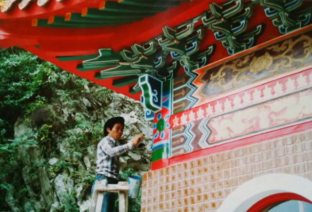
It was in the middle of repainting and refreshing the colors.
ペンキの塗り替え、お色直しの最中でした。

This is the lower reaches of the Lihu River, which flows through Taroko Gorge about 4 kilometers from Changchun Shrine. The shadows of the mountains are reflected on the river’s surface, and a large stone monument can be seen on the left. From here on, the climb begins in earnest.
長春祠から4キロほど太魯閣峡谷を流れる川、立霧渓(リーフーシー)の下流部です。川面に山影が映り、左に大きな石碑が見えます。この先、いよいよ上りが始まります。
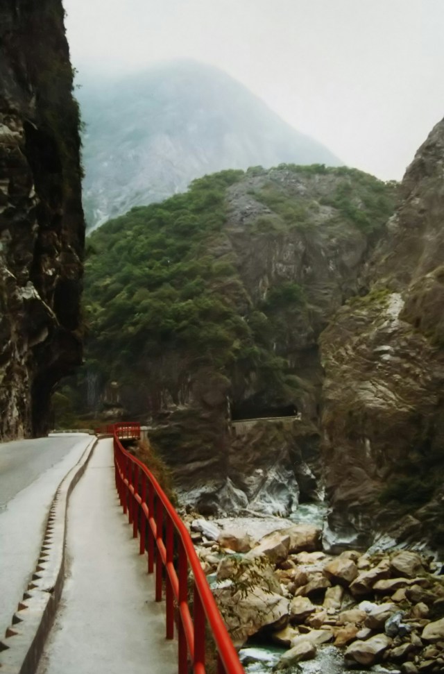
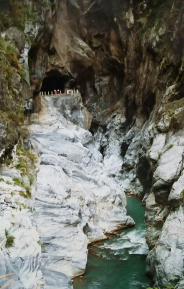
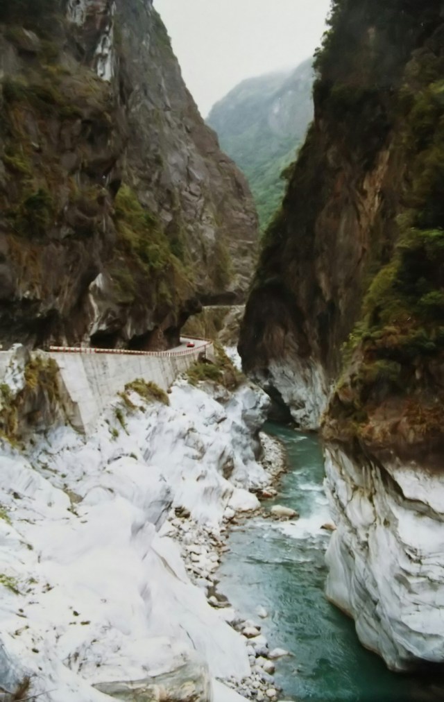
After running just 5 kilometers, the scenery changes completely. The river narrows, and you’ll find a succession of unlined tunnels and sheer cliffs. The geology in this area consists of marble layers formed from uplifted underwater coral reefs. The white sections in the photo are that marble. The Hualien area is a major source of marble, which is exported to Japan and processed into items such as gravestones. Additionally, many of the torii gates at Japanese shrines are made from Taiwanese cypress.
5キロも走るとあたりが一変します。川幅は狭まり、素掘りのトンネルや切り立った断崖が続きます。このあたりの地質は海底の珊瑚礁が隆起した大理石層です。写真の白い部分がその大理石です。花蓮周辺は大理石の産地で、日本へ輸出されて墓石などに加工されています。また、日本の神社の鳥居の多くも台湾産の檜です。
You can really see how the cliff face was carved out to make way for the road. I think the size of the cliff becomes apparent when you compare it to the car. This area is probably the highlight of Taroko Gorge.
道を通すために断崖をくり抜いたのがよくわかります。車と比較して断崖の大きさが感じられると思います。このあたりが太魯閣峡谷のハイライトでしょうか。

As I ventured further in, another river flowed into the Tachibana Valley, and the landscape suddenly opened up. Spanning the confluence is the marble “Cimu Bridge.” While there are various theories about the origin of its name, one story goes that a mother who was trying to deliver a lunchbox to her son working on a road construction project was swept away by a flood, and the bridge was named in her memory to mourn her death. Ironically (?), the bridge shown in the photo was actually swept away by a flood. The bridge currently in place is the second version.
さらに奥へと進むと立霧渓に別の川が流れ込み、急にあたりが開けてきました。その合流部に大理石の「慈母橋」が架かっています。名前の由来は諸説ありますが、その一つに、道路工事で働く息子のためにお弁当を届けようとした母親が洪水で流されてしまい、その死を悼んで橋の名を刻んだといわれます。写真の橋ですが、皮肉(?)なことに本当に洪水で流されてしまいました。現在架かっている橋は二代目になります。
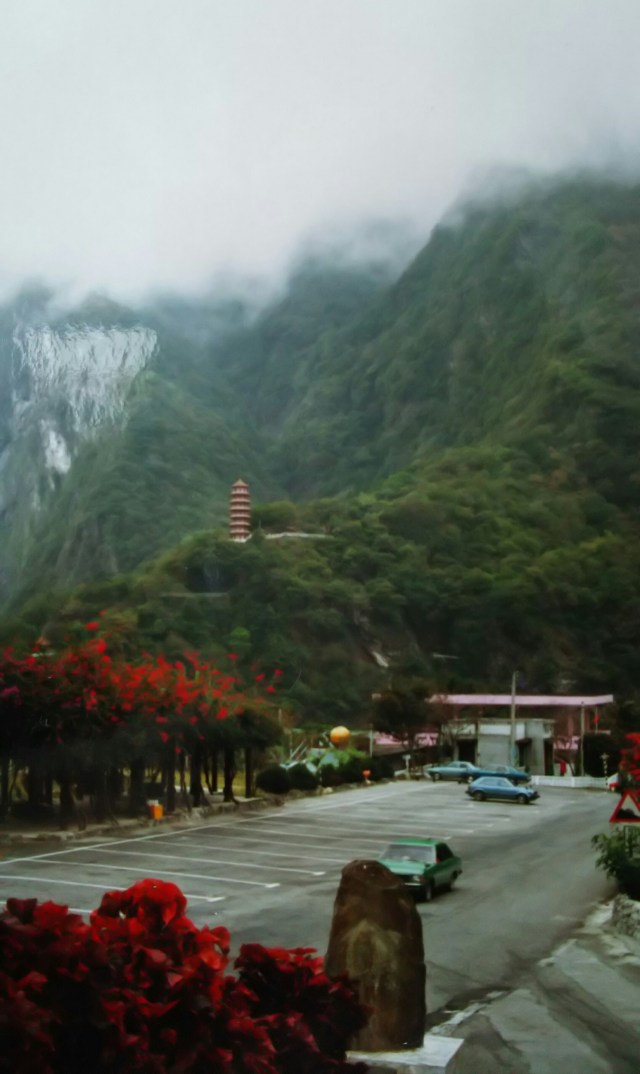
I have arrived in Tianxiang. Tianxiang is a spot that suddenly opens up amidst the mountains, lined with hotels, restaurants, and shops. The photo was taken from the parking lot of the Tianxiang Plum Garden, showing the seven-story pagoda, “Tianfeng,” at Xiangde Temple, a Rinzai Zen nunnery on the opposite bank. You can see the fog rolling down from the mountains.
天祥に到着しました。天祥は山あいに急に開けた場所でホテルを始めレストランや売店などが並んでいます。写真は天祥梅園の駐車場から対岸の臨済宗の尼寺「祥徳寺」の七重の塔「天峯塔」を撮ったものです。山から霧が降りてきたのがわかります。
